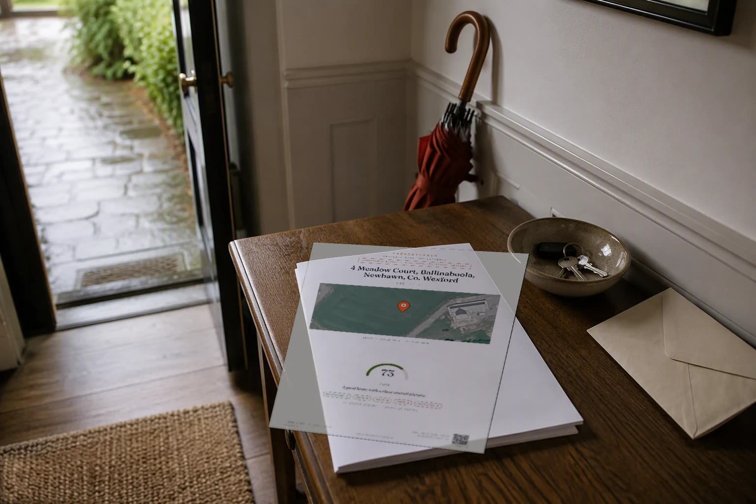
Sample Report · Anonymised · Real Data
See exactly what you get.
Flip through all 26 pages of a real, anonymised report: official risk checks, maps, comparable sales, a BER deep dive and a buyer action plan.
The Sample
Real data.
One masked Eircode.
A real PropertyPack our pipeline produced for a County Wexford home in September 2026: every number pulled from live official records. We changed the address and masked the Eircode; everything else is exactly what you would receive.
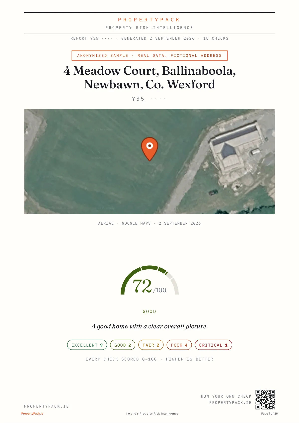
72/100. A good home with a clear overall picture.
The overall score weighs every check in the report, with flood, BER, prices and running costs counting most.
26 dense pages, opens in a new tab, or scroll to flip through every page below.
The Walkthrough
Every page, explained.
Scroll through all 26 pages of the actual report. We have annotated the ones buyers ask about most: what the page shows and why it matters when you are about to bid.
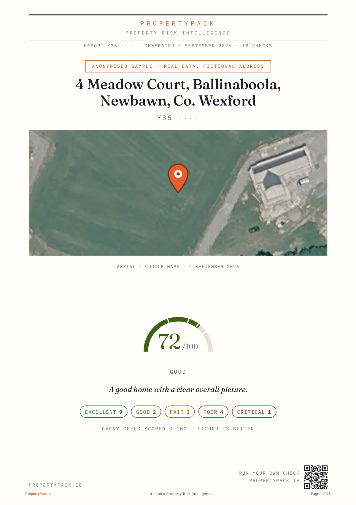
Page 1 of 26
Page 1 of 26
The verdict, before anything else
The overall score sits right on the cover (72/100 for this Wexford home, with the grade spread across all 18 scored checks under the dial) beneath the aerial photo and full address. You know where the property stands before you turn a page.
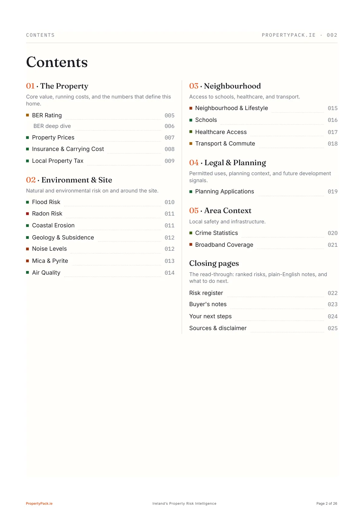
Page 2 of 26
The contents: five sections plus the closing pages, every check page-numbered.
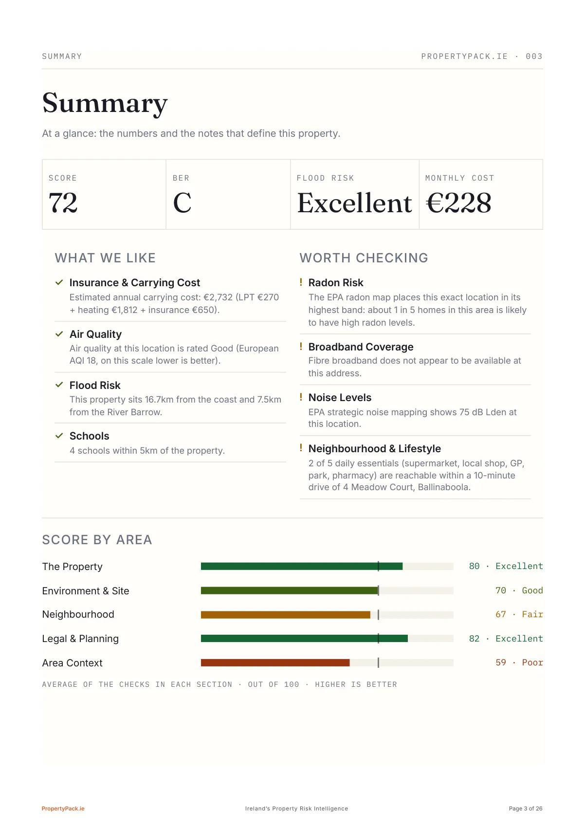
Page 3 of 26
The whole property on one page
The 'worth checking' column surfaces the radon flag, the missing fibre, the road noise and the thin ten-minute radius immediately (the things you'd want to know before falling for the kitchen), set against what we like, with score, BER, flood risk and monthly running cost across the top.
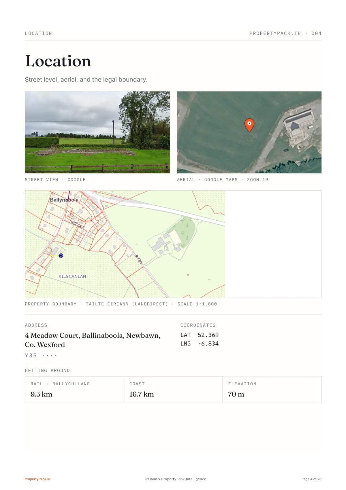
Page 4 of 26
Street, sky, and the legal boundary
The framed map is the Tailte Éireann (Landdirect) cadastral view, the register your solicitor checks the folio against; a paid pack outlines the registered boundary on it, the anonymised sample shows the area. Above it, street view and aerial; underneath, the distances that shape daily life here: rail 9.3km, coast 16.7km, 70m elevation.
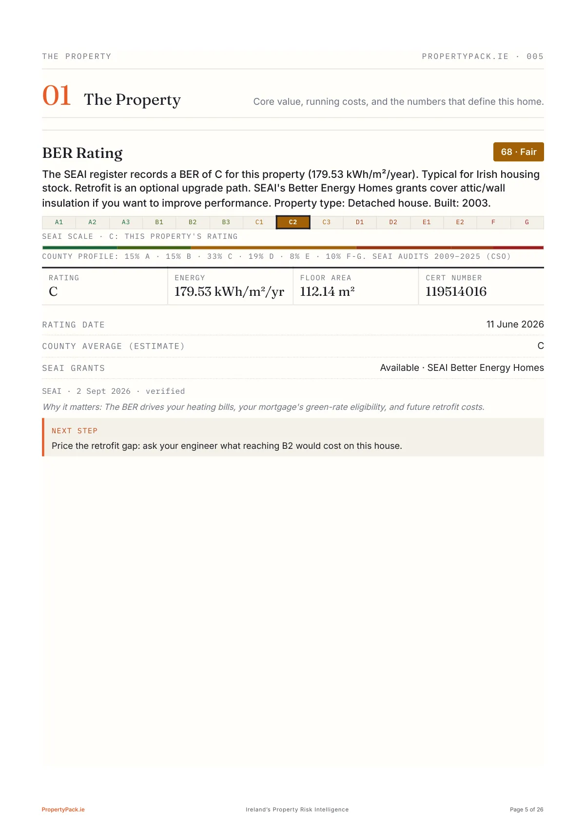
Page 5 of 26
The check pages begin: BER C from the SEAI register, cert number, floor area and the county profile.
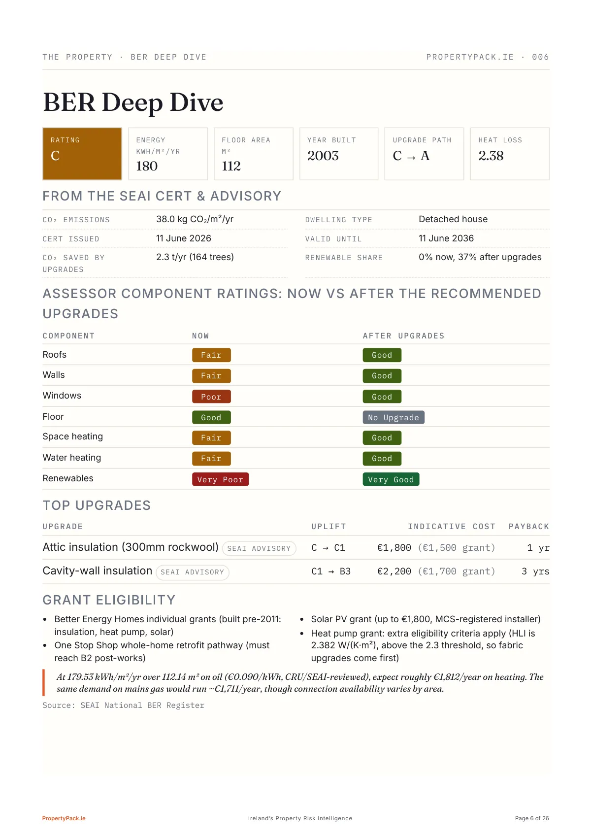
Page 6 of 26
The BER cert, pulled apart
Component-by-component assessor ratings now versus after the recommended works, the top upgrades costed with their SEAI grants (attic insulation pays back in a year), heat-pump eligibility maths, and what heating really costs on oil versus mains gas.
Read the full guide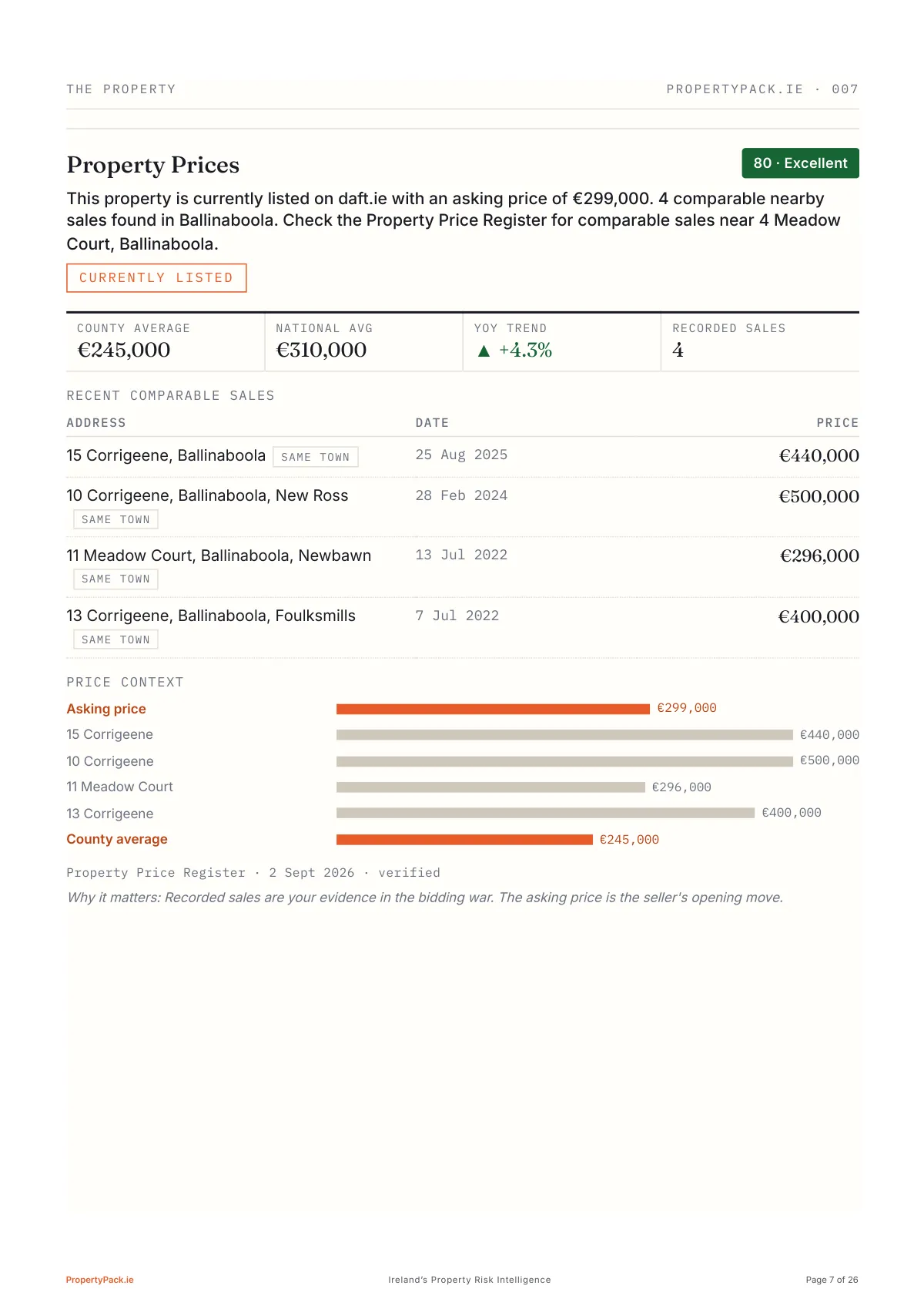
Page 7 of 26
Is the price fair?
The €299,000 asking, checked against the Property Price Register: four recorded sales in the same townland, from €296,000 to €500,000, county and national averages, the year-on-year trend, and a price-context chart that puts the asking price beside every one of them.
Read the full guide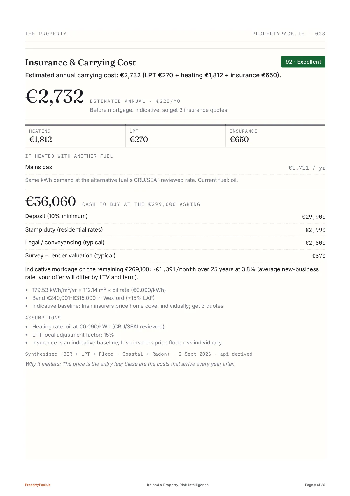
Page 8 of 26
What it costs to actually live in
€36,060 cash needed on the day at this asking price (deposit, stamp duty, legal fees and survey) and above it, €2,732 a year to carry the house once it's yours: heating, LPT and insurance broken out, plus what the same heat would cost on mains gas. Numbers nobody volunteers at a viewing.
Page 9 of 26
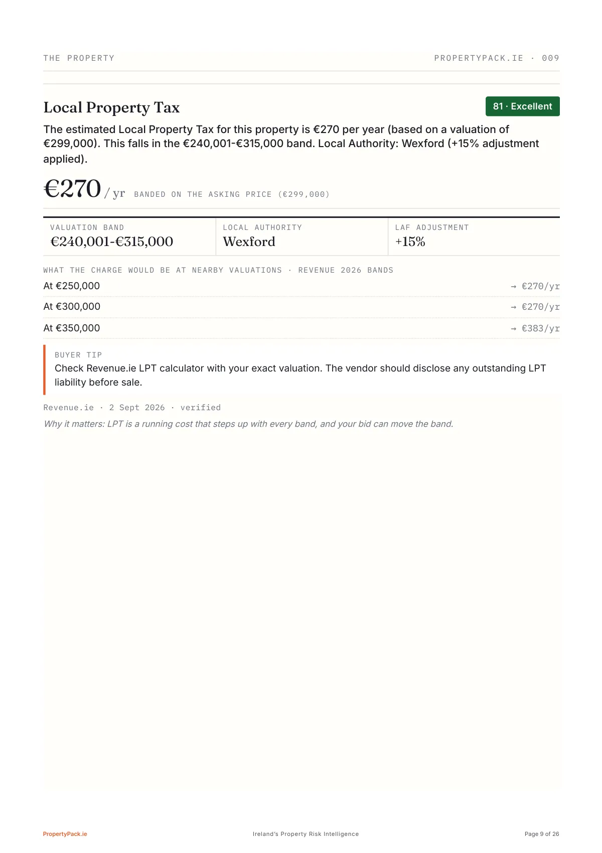
The estimated Local Property Tax: €270 a year in the €240,001-€315,000 band after Wexford's +15% adjustment, with the charge at nearby valuations.
Page 10 of 26
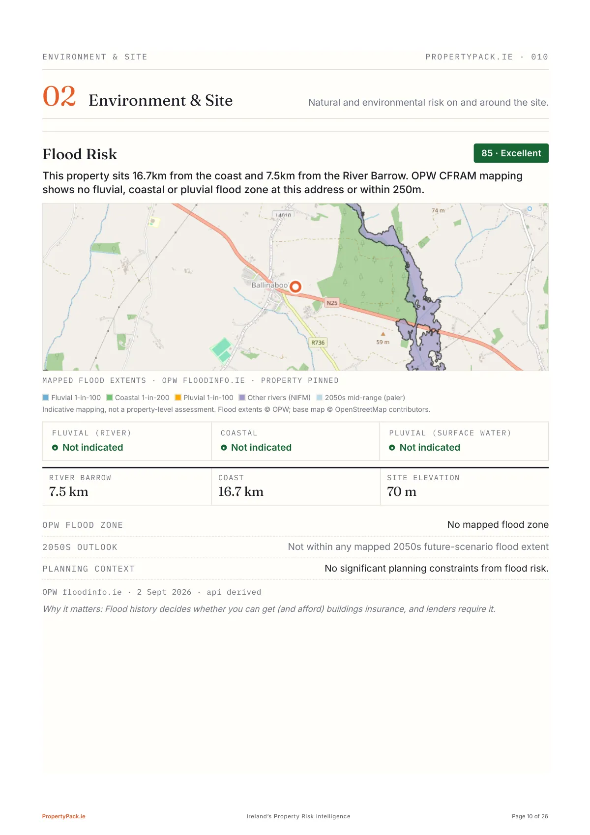
Flood zones, drawn on OPW's own map
The map is OPW's mapped flood extents around the pin, not a terrain tile: the 1-in-100-year river and surface-water zones, the 1-in-200-year coastal zone, other rivers from the national indicative mapping, and the 2050s mid-range scenario as a paler halo. Here the nearest extent is the stream east of the village and nothing touches the house. Below it, the three flood-type chips, the River Barrow at 7.5km, the coast at 16.7km, and the 2050s outlook, because the insurer will check it.
Read the full guide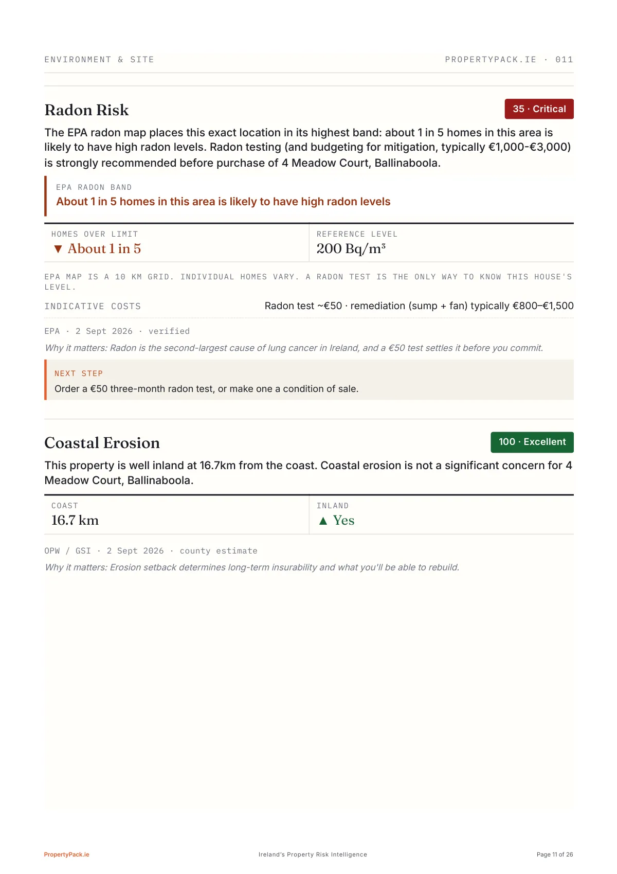
Page 11 of 26
Flagged on radon
The EPA radon map puts this exact location in its highest band: about 1 in 5 homes in the area likely above the 200 Bq/m³ reference level. A county average would have missed it. The report says test before purchase (about €50) and what mitigation costs (€800-€1,500). Coastal erosion, by contrast, scores a clean 100: well inland.
Read the full guide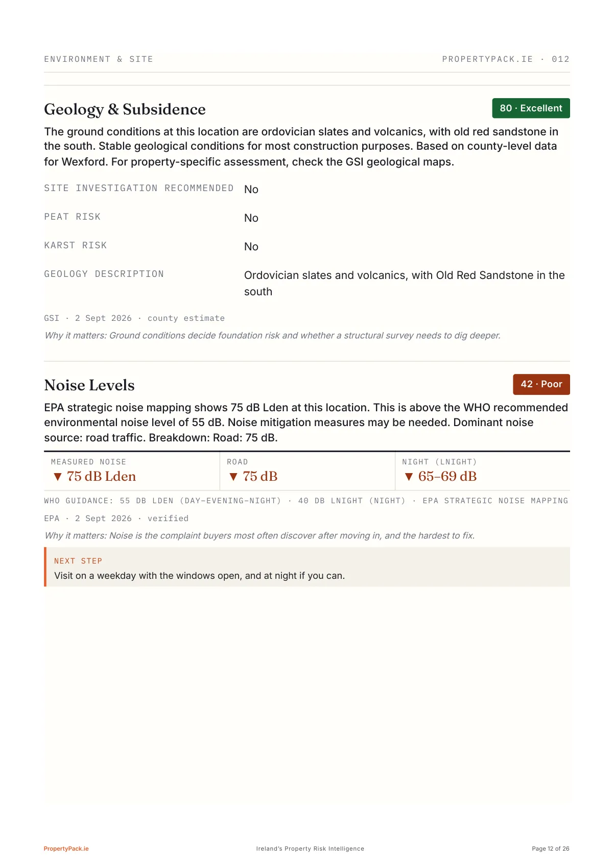
Page 12 of 26
Geology & subsidence, then noise: 75 dB Lden from road traffic at this location, well above the WHO's 55 dB guidance.
Page 13 of 26
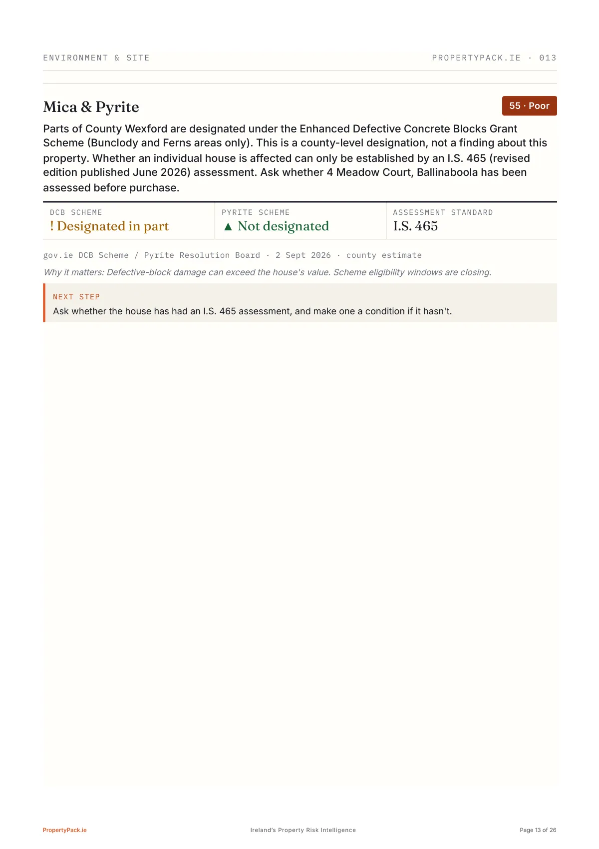
Mica & pyrite: Wexford is designated in part under the defective concrete blocks scheme, so the pack asks for an I.S. 465 assessment.
Page 14 of 26
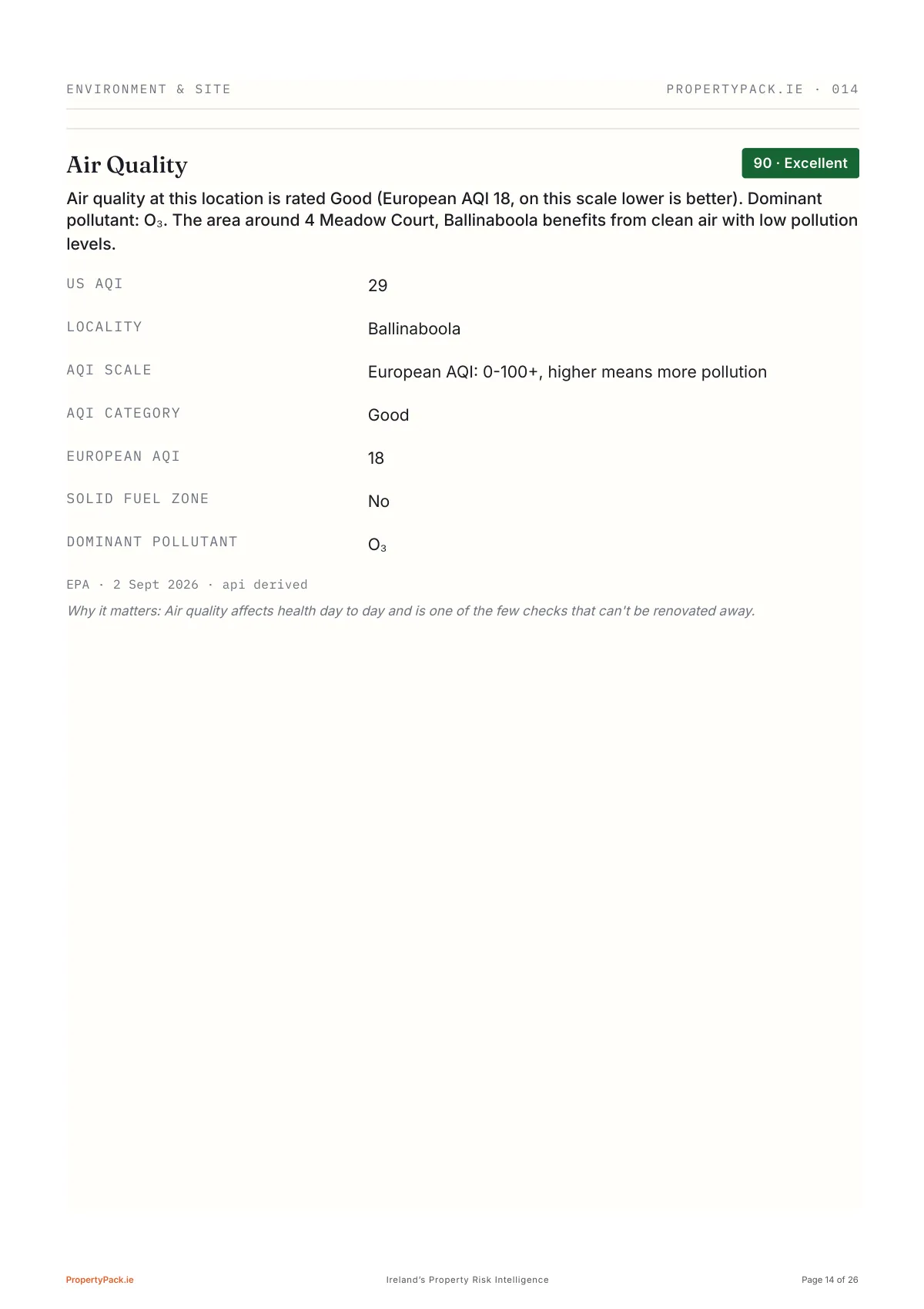
Air quality at this location: Good, European AQI 18, dominant pollutant ozone.
Page 15 of 26
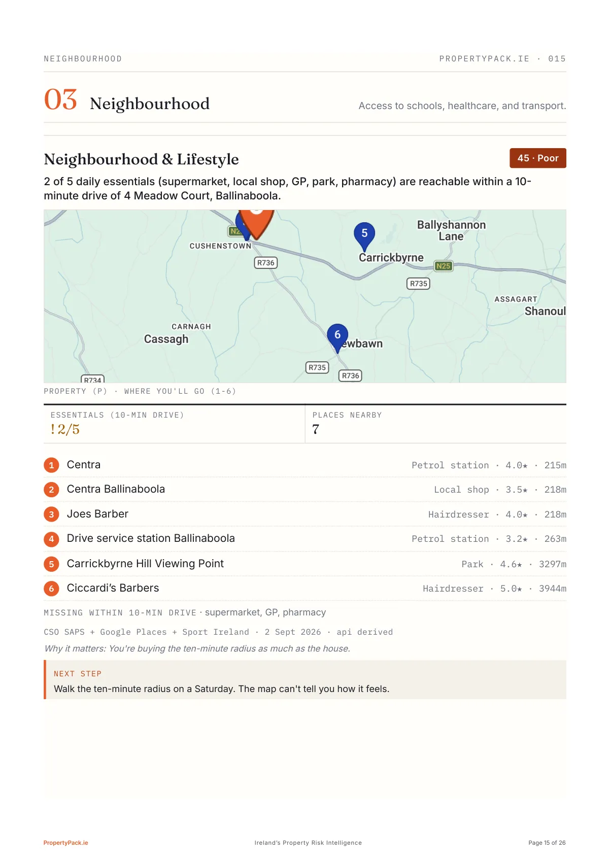
The ten-minute radius, mapped
Daily essentials within a 10-minute drive: 2 of 5, with supermarket, GP and pharmacy missing. Six places mapped and timed, from the petrol station 215m away to a viewing point 3.3km out. Then the honest next step: walk the radius on a Saturday, because the map can't tell you how it feels.
Page 16 of 26
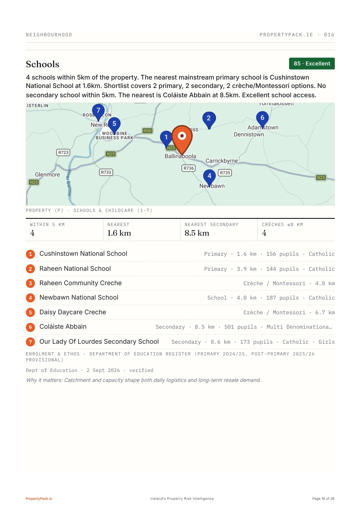
Every school in range with distance, enrolment and ethos: four within 5km, nearest primary 1.6km, nearest secondary 8.5km.
Page 17 of 26
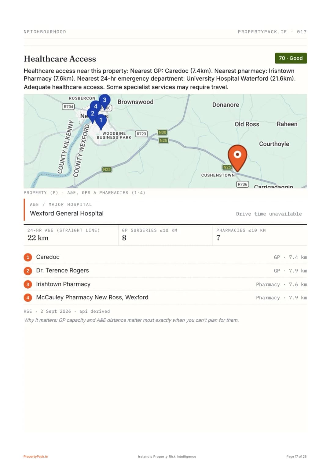
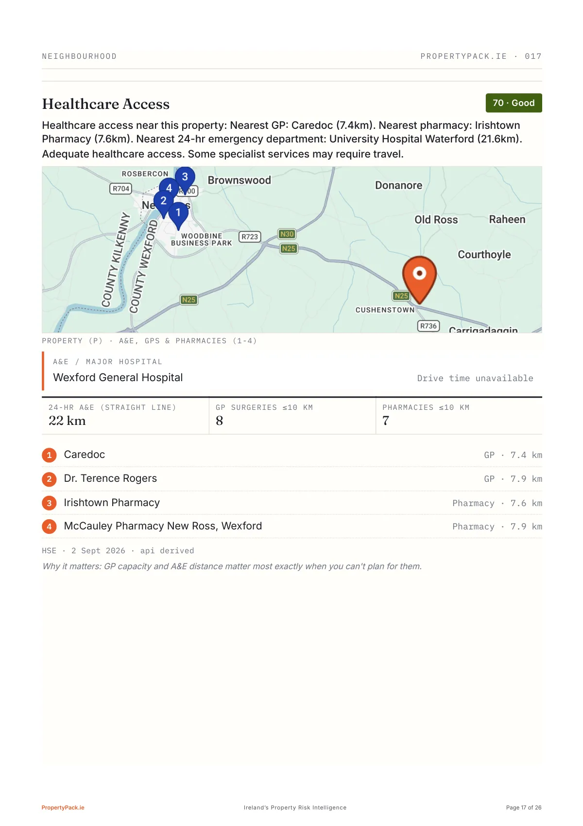
Healthcare access: nearest GP 7.4km, nearest pharmacy 7.6km, nearest 24-hour A&E 22km, all mapped and counted.
Page 18 of 26
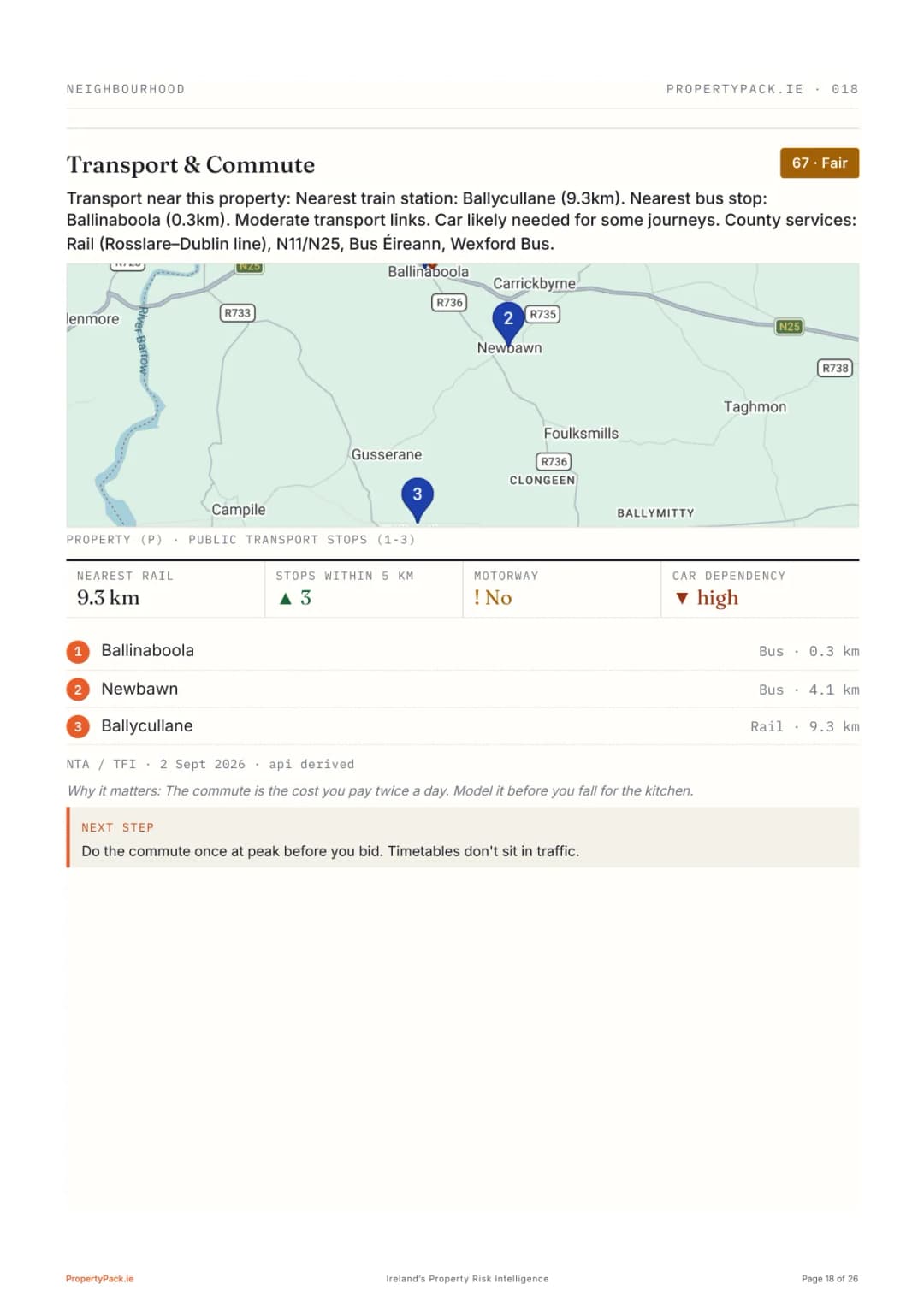
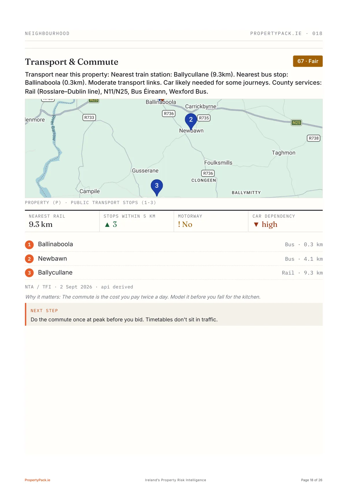
The transport reality: nearest rail 9.3km, bus stop 300m, no motorway, car dependency rated high.
Page 19 of 26
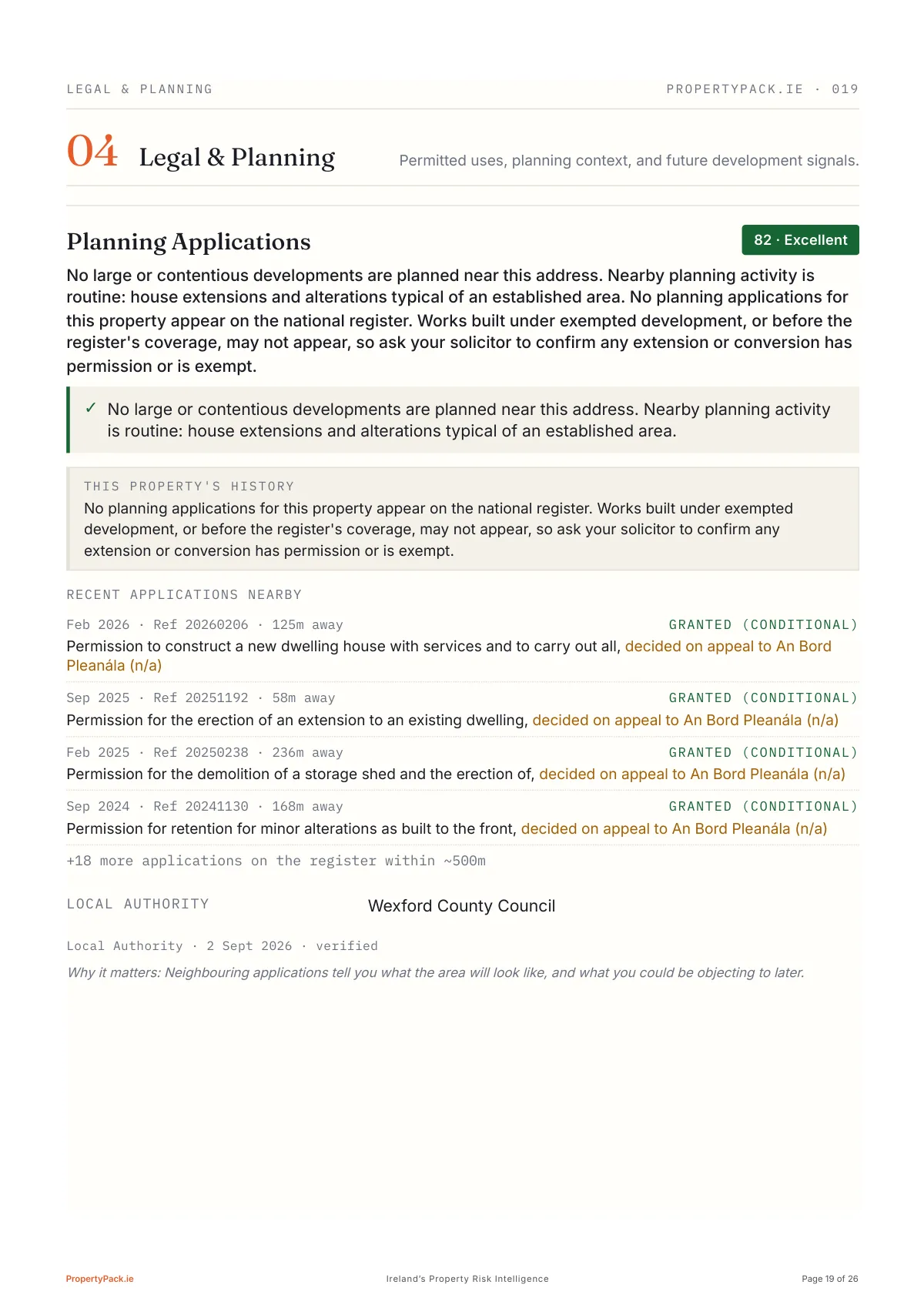
What's being built around you
The verdict first (nothing large or contentious nearby), then this property's own register history, then the recent applications within ~500m with distance and reference: a new dwelling 125m away, an extension 58m away, 22 on the register in all. Ask your solicitor to confirm any extension or conversion has permission or is exempt.
Read the full guide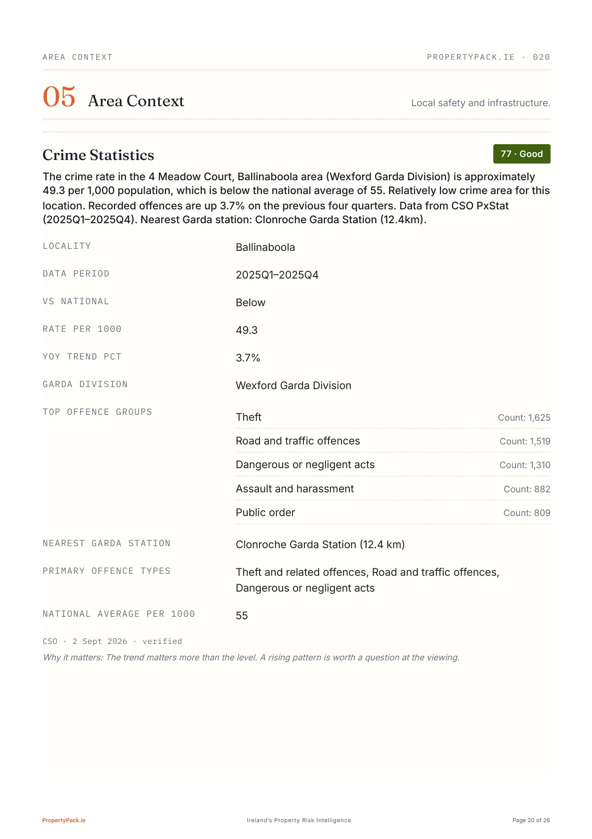
Page 20 of 26
Crime statistics from CSO PxStat: 49.3 per 1,000 against a national 55, the top offence groups, and the nearest Garda station named.
Page 21 of 26
The report doesn't sugarcoat
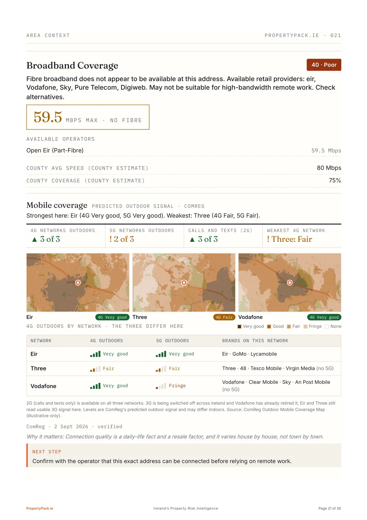
The honest bad news: no fibre at this address, 59.5 Mbps max, which matters if remote work is part of the plan. Underneath, mobile coverage from ComReg: strongest and weakest network in one line, 4G and 5G as signal bars for Eir, Three and Vodafone with the brands that ride each, and three coverage maps because the networks genuinely differ here.
Read the full guide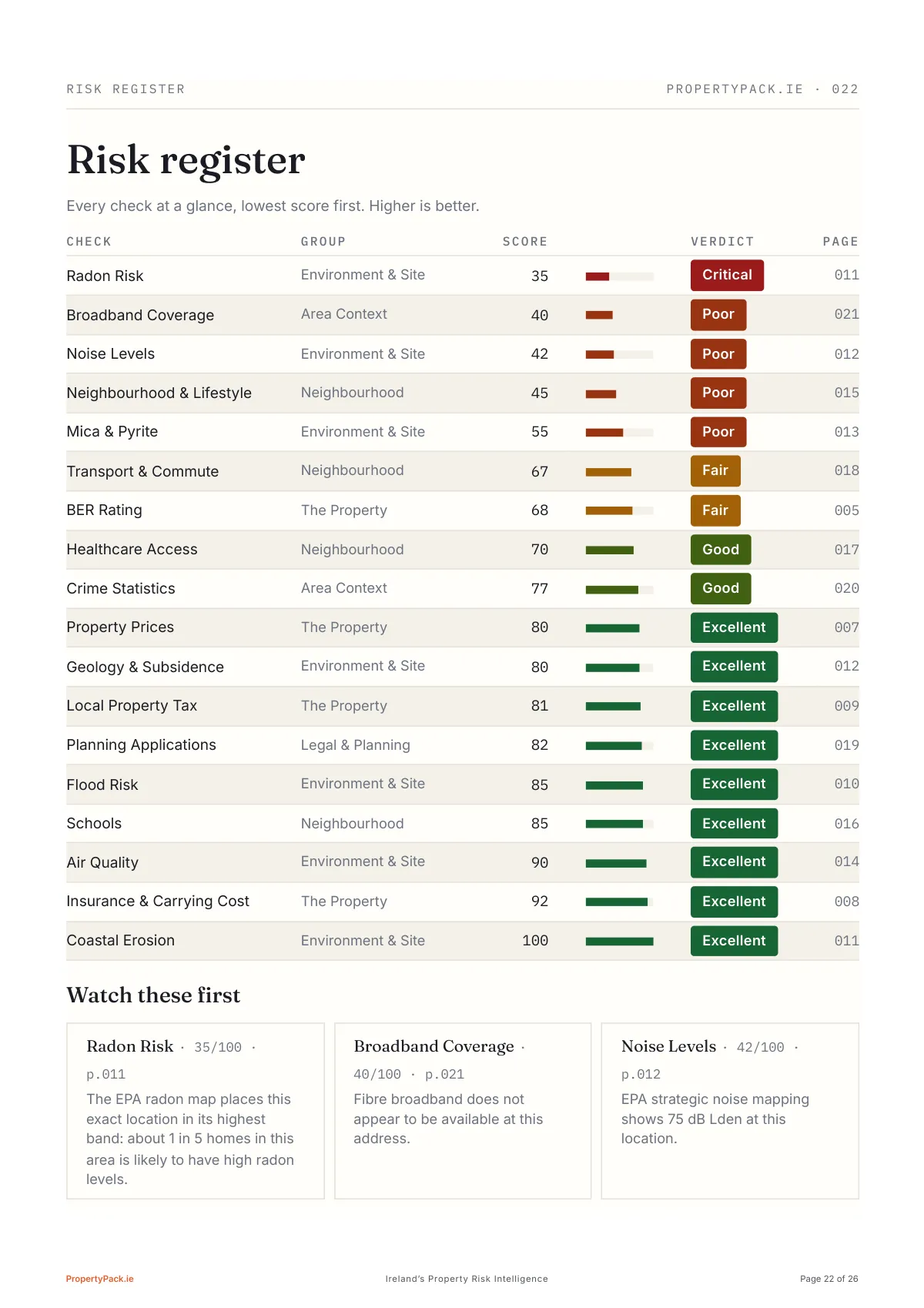
Page 22 of 26
Nothing gets buried
Every check ranked lowest score first, so the property's real weaknesses (radon 35, broadband 40, noise 42, neighbourhood 45) sit at the top with page references, and the three to watch are pulled out underneath. This is the page to hand your solicitor.

Page 23 of 26
Our read, in plain English
A narrative synthesis rather than a data dump, opening with the single most important action (a €50 radon test kit, in place three months before closing), then four viewing-day checks, like running a speed test from the house's actual ethernet port.
Page 24 of 26
Questions ready to use
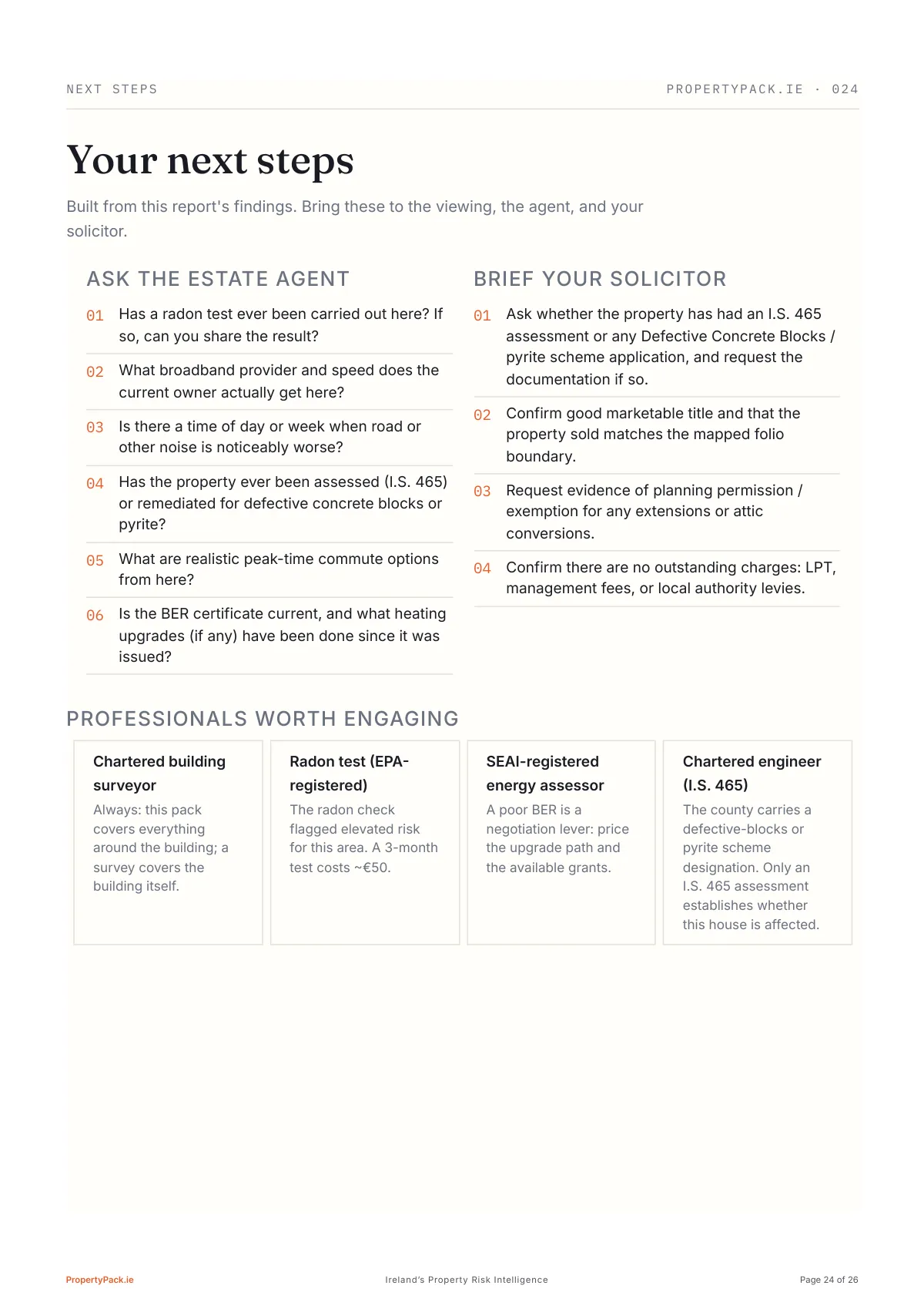
Six questions for the estate agent, four instructions for your solicitor, and which professionals to engage, each generated from this report's findings, not a generic checklist. The radon question is on the list because page 11 put it there.
Page 25 of 26
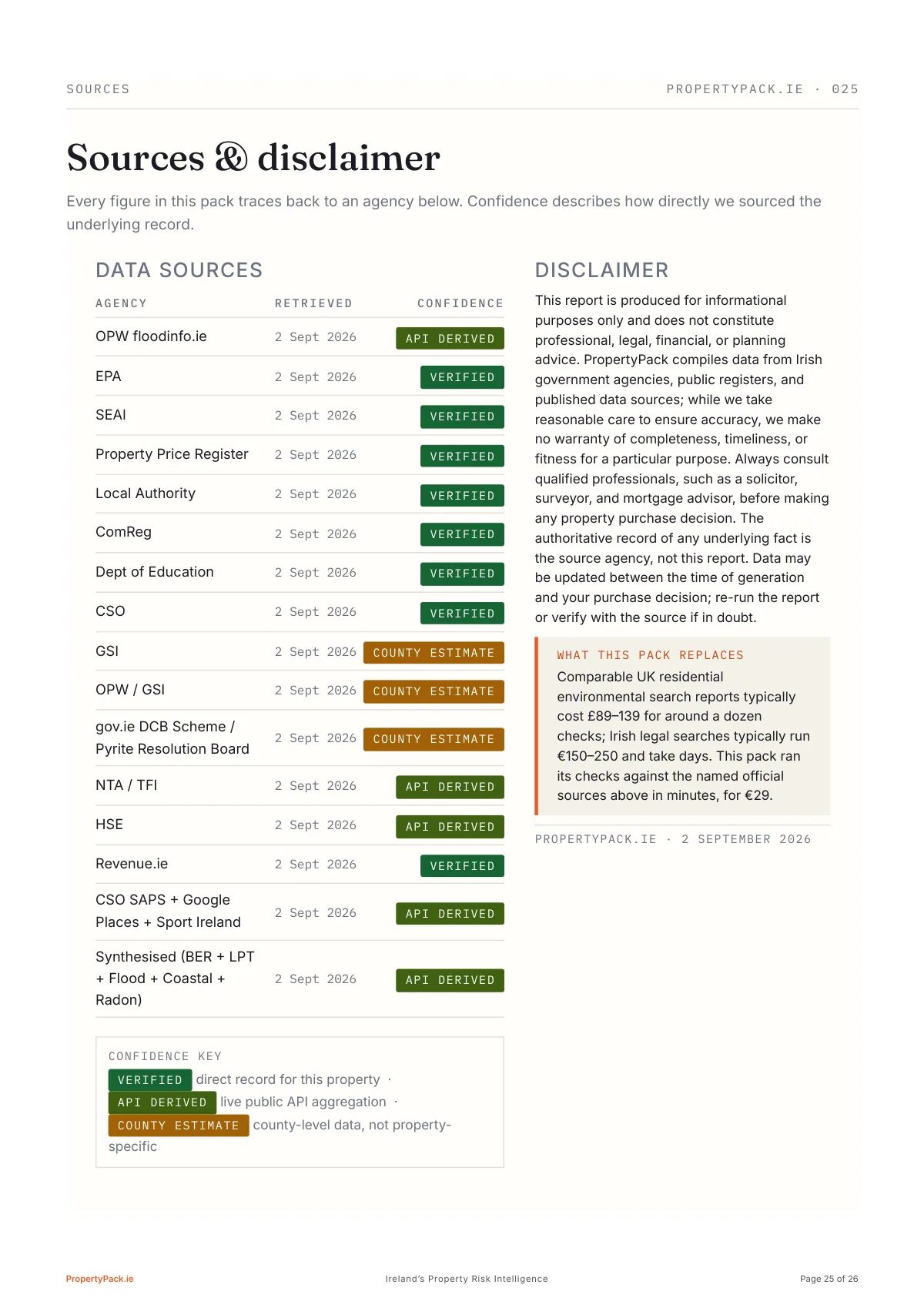
Every figure traced to its agency, dated, and graded: verified, API-derived, or county estimate.

Page 26 of 26
The back cover: 18 checks scored, 16 official sources, and two to three minutes to re-run before you bid.
Free snapshot, no card, no account. Full report €29.
The Specification
What the 18 checks cover.
The pack above was generated in September 2026 with the current pipeline, so it runs the same 18 checks below, including defective concrete (mica/pyrite), each cited to its official source. This list renders from the same registry the report pipeline runs, so it is always the current product. Tap a check to read its guide.
Flood Risk
OPW floodinfo.ie
02Radon Risk
EPA
03BER Rating
SEAI
04Property Prices
Property Price Register
05Planning Applications
Local Authority
06Broadband Coverage
ComReg
07Schools
Dept of Education
08Crime Statistics
CSO
09Air Quality
EPA
Noise Levels
EPA
Geology & Subsidence
GSI
Coastal Erosion
OPW / GSI
Mica & Pyrite
gov.ie DCB Scheme / Pyrite Resolution Board
Transport & Commute
NTA / TFI
Healthcare Access
HSE
Local Property Tax
Revenue.ie
Insurance & Carrying Cost
Synthesised (BER + LPT + Flood + Coastal + Radon)
Neighbourhood & Lifestyle
CSO SAPS + Google Places + Sport Ireland
Want the detail behind the checks? See how an Eircode property check works, compare it with a surveyor in property report options in Ireland, or work through the 12-step buying-a-house checklist.
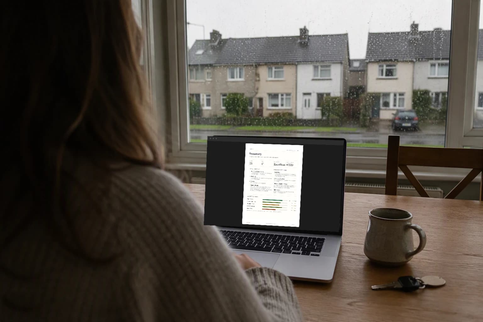
Your Own Property
Now run the same checks on the house you want.
The sample above is one home. Enter any Eircode for a free snapshot, then unlock the full 18-check report for €29.
Frequently Asked Questions
About the sample report.
Is the sample report a real property?
Yes. It is a real report the PropertyPack pipeline produced for a County Wexford home, generated in September 2026 with the current checks. The address was changed and the Eircode masked; every figure, map and score is otherwise exactly what the buyer received.
How many pages is a PropertyPack report?
The sample runs to 26 pages: a scored summary, the 18 check sections, maps, comparable sold prices, a BER deep dive and a buyer action plan. Every page is shown and annotated in the walkthrough above.
What does the overall score mean?
The score is out of 100 and weighs every check in the report, with flood risk, BER, sold prices and running costs counting most. It is a summary of the official data behind the address, not a valuation or a survey: the section pages show which checks pulled it up or down, and each cites the source it was read from.
How long does a PropertyPack report take, and what does it cost?
A free snapshot for any Eircode is ready in about a minute. The full 18-check PDF costs €29 for one property and follows in 2-3 minutes, compiled from 12 official Irish sources.
Official data sourced from Irish government agencies