Property Report: Co. Donegal
Comprehensive 10-section property risk analysis for Co. Donegal, Ulster
Donegal, a predominantly rural county in Ulster with approximately 167,000+ residents, offers a landscape defined by rugged Atlantic coastline. Property buyers in Donegal face specific considerations with exposure to Atlantic weather systems along its coastline. A PropertyPack report for Donegal analyses 10 risk categories, from radon levels to broadband availability, giving you the full picture before you commit.
Search a Donegal Property
Get your personalised property report in minutes
Co. Donegal at a Glance
167,000
Ulster
Coastal county
Predominantly Rural
Erne, Swilly, Finn
Property Risk Overview for Donegal
Flood Risk
Donegal has 3 major river systems (Erne, Swilly, Finn) and a coastal boundary, creating both fluvial and coastal flood risk. Low-lying areas near river flood plains require careful assessment. OPW flood maps should be reviewed for any property in Donegal.
Radon Risk
Donegal's underlying granite geology places it in a higher-risk zone for radon gas. The EPA classifies areas with granite bedrock as more likely to have elevated indoor radon levels. Property buyers in Donegal should consider radon testing, and our report flags the EPA zone classification for any address.
Mica & Pyrite
Donegal is one of the counties most affected by defective concrete blocks containing muscovite mica. Properties built between 2000 and 2020 may be at risk. The government's Defective Concrete Blocks Grant Scheme covers affected homeowners, but pre-purchase checks are essential.
BER Energy Ratings
Rural housing in Donegal frequently features older construction with lower BER ratings, often in the D to G range. Solid-fuel heating and poor insulation are common in pre-2000 builds. Upgrading to a B2 rating can cost between EUR 25,000 and EUR 60,000 depending on the property.
Crime Statistics
The Donegal Garda division covers Donegal, where crime rates are moderate relative to the national average. Urban centres like Letterkenny see higher activity than surrounding rural areas. PropertyPack includes local crime rate data sourced from CSO and An Garda Siochana.
Planning Activity
Planning activity in Donegal is relatively modest, with applications typically involving rural dwelling houses, agricultural buildings, and small-scale commercial premises. Wind farm and renewable energy applications are increasingly common. Your report checks for nearby planning activity.
School Access
School options in Donegal are concentrated in Letterkenny and Buncrana. Some rural areas rely on school transport services for post-primary education. Your report identifies primary and secondary schools nearest to the property.
Water Quality
Many rural properties in Donegal depend on private well water or group water schemes rather than public mains supply. Well water quality can vary and is not always tested regularly. Your PropertyPack report identifies the water supply type and flags any EPA or Irish Water advisories for the area.
Broadband Coverage
Rural broadband remains a challenge in Donegal, where many areas are served by the National Broadband Plan rollout. FTTH is available in Letterkenny but coverage drops off quickly in surrounding townlands. Satellite and fixed wireless may be the only options in remote areas.
Air Quality
Donegal benefits from excellent air quality, consistent with its rural character and low traffic volumes. Winter solid-fuel burning in towns like Letterkenny may cause localised particulate spikes. EPA monitoring data for the nearest station is included in your report.
Donegal by the Numbers
167,000
Population
Ulster
Province
3
Major Towns
3
Main Rivers
Coastal
Coastline
Predominantly Rural
Character
Towns & Areas in Donegal
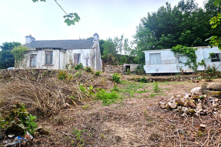
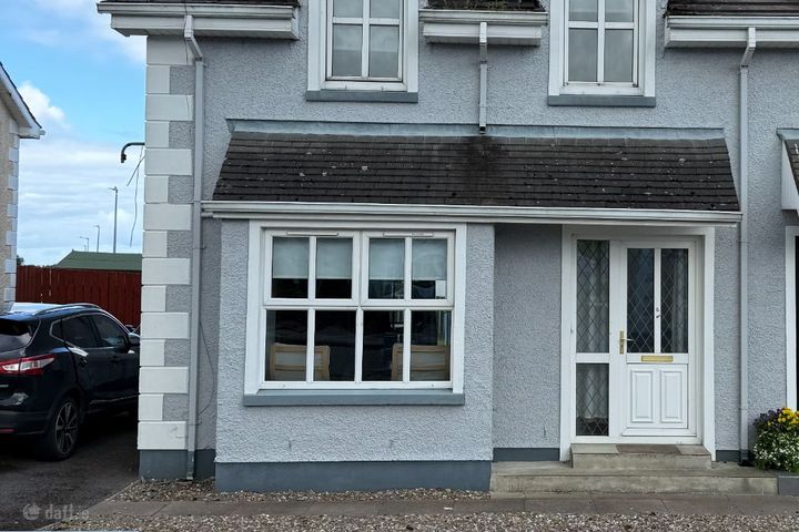
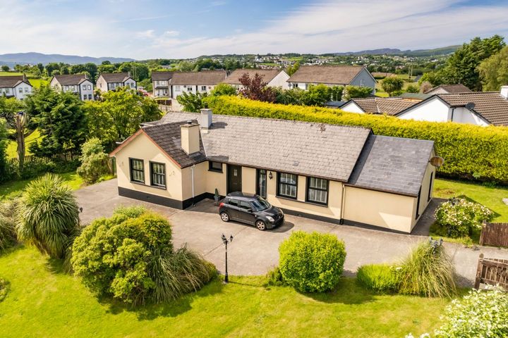
Properties for Sale in Donegal
Latest properties on the market in Co. Donegal. Click “Check Risks” to run a PropertyPack report on any listing.
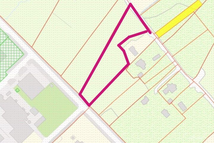
Carrickataskin, Derrybeg, Derrybeg, Co. Donegal, F92P7X0
Ballindrait, Bunbeg, Bunbeg, Co. Donegal, F92F8N8
103 White Maples, Church Road, Bundoran, Co. Donegal, F94VR9...

Rosapenna, Kinnalargy, Downings, Co. Donegal, F92HY80
Milltown, Buncrana, Buncrana, Co. Donegal, F93D9C6
Sandfield, Ardara, Rossbeg, Co. Donegal, F94E7C7
Donegal Property Report FAQs
Donegal has both coastal and river flood risk due to its 3 major river systems (Erne, Swilly, Finn) and shoreline exposure. The OPW maintains detailed flood maps for all areas. A PropertyPack report checks the specific flood zone classification for any Eircode in Donegal.
Yes, Donegal's granite bedrock makes it a higher-risk area for radon gas according to the EPA. Radon is the second leading cause of lung cancer in Ireland. We recommend radon testing for any property purchase in Donegal, and our report indicates whether the address falls within an EPA high radon area.
Rural counties like Donegal tend to have lower average BER ratings, often in the D-E range, reflecting older construction methods and solid-fuel heating. Upgrading energy efficiency is a significant cost consideration. Your report includes any available BER certificate data from the SEAI register.
The main environmental considerations for property in Donegal include coastal erosion and storm surge, river flooding, elevated radon levels, mica-affected concrete blocks. A comprehensive PropertyPack report analyses all 10 risk categories so you can make an informed decision.
Broadband can be a challenge in rural Donegal. While Letterkenny has fibre coverage, many rural townlands rely on the National Broadband Plan, fixed wireless, or satellite internet. Checking broadband availability is essential before purchasing and is included in every PropertyPack report.
Donegal has primary schools in most communities, with post-primary options concentrated in Letterkenny and Buncrana. Rural families may need to factor in school transport. Your PropertyPack report lists the nearest schools by distance and provides key information about each.
A PropertyPack report for Donegal analyses 10 risk categories: Flood Risk, Radon Risk, Property Prices, Broadband Coverage, Crime Statistics, Schools, Planning Applications, Air Quality, BER Rating, Transport & Commute. Each category uses official data from government agencies like the OPW, EPA, CSO, and SEAI. Simply paste the listing link for any property in Donegal to generate your personalised report.
Getting a property report for any address in Donegal is straightforward. Paste the property's Daft.ie or MyHome.ie listing link on this page or on our homepage, choose your plan, and receive a comprehensive report covering all 10 risk categories. Reports are generated using real-time data from official Irish government sources.
Get Free Donegal Property Alerts
We'll send you property risk insights, market updates, and a heads-up before our introductory €29 report price goes up.
No spam. Unsubscribe anytime. We never share your email.
Property Reports for Neighbouring Counties
Check any property in Donegal
Paste a Daft.ie or MyHome.ie listing link to get a comprehensive 10-section property risk report for any property in Co. Donegal.