Commuting from Co. Louth: Times & Transport A and B BER ratings more common than nationally. Homes sell 5% below the State median.
PropertyPack provides a 24-section property report for any address in Louth, Leinster. With a population of 139,000+ and a landscape characterised by compact farmland between the Cooley Mountains and the Irish Sea coastline, Louth presents its own property risk factors, from flood risk along the Boyne, Fane and Dee to BER ratings, crime statistics and nearby schools, each checked against official data and cited to its source.
Free snapshot in about a minute. No card, no account.
 Co. Louth · Leinster · 139,000 people
BER audits rated A or B
Recorded crime, per 1,000 a year
Division-wide figure for the Louth/Cavan/Monaghan Garda Division.
County median price, 2025, CSO
Recorded past flood events
16th of 26 counties.
Sources: SEAI BER audits via CSO, 2009–2025. CSO recorded crime by Garda division (CJQ10), 2025Q3–2026Q2. Population: Census 2022. CSO residential property prices, 2025. OPW (Office of Public Works): Flood Risk Management County Summaries & Past Flood Events, floodinfo.ie.
Properties for Sale in Louth
Latest properties on the market in Co. Louth. Click “Check Risks” to run a PropertyPack report on any listing.
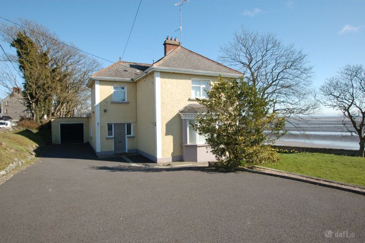
Grianan Mhuire, Main Street, Blackrock, Blackrock, Co. Louth...
The house itself
That's the county. Now check the house.
The pack finds the nearest rail with its weekday departures and the stops within 5 km, and runs 23 more checks at the address.
Free snapshot in about a minute. No card, no account.
Every pack runs 24 checks at the addressgrouped as in the report
The Property
Environment & Site
Questions buyers ask
What does a PropertyPack report cover for Louth properties?
24 checks for the Eircode you enter: Flood Risk, Radon Risk, BER Rating, Property Prices, Planning Applications, Broadband Coverage, Schools, Crime Statistics, Air Quality, Noise Levels, Geology & Subsidence, Coastal Erosion, Mica & Pyrite, Transport & Commute, Healthcare Access, Local Property Tax, Insurance & Carrying Cost, Neighbourhood & Lifestyle, Protected Structures & Monuments, Knotweed & Giant Hogweed, Buying Costs & Schemes, Water & Sewerage, Industry & Land Use Nearby and Planned Infrastructure Nearby. They draw on 16 official Irish sources, including the OPW, EPA, SEAI, CSO and the Property Price Register, and every check card cites its source. Where a dataset is only published at county or Garda-division level, the report labels that confidence level.
How much does a property report for Louth cost?
The full 24-check PDF report for any Louth address costs €49. House-hunting across several properties? A 3-report bundle is €99 and a 5-report bundle is €129. You see a free snapshot first, no card needed.
Where does PropertyPack get its commute guide data for Louth?
Transport data combines National Transport Authority rail timetables with mapped stops and, where routing answers, road drive times. Each check runs for the exact Eircode, and any figure only published at county or Garda-division level is labelled as such.
Which areas of Louth have the lowest property risk?
Risk levels vary across Louth depending on which factor you're considering. Properties away from Boyne, Fane and Dee flood plains have lower flood risk. For radon, 10.1% of homes tested in Louth measured over the Reference Level. The EPA's map shows which areas are classified as High Radon Areas. Broadband, crime and school access are checked for the exact Eircode, so two addresses in Drogheda, Dundalk, Ardee can be compared like for like. PropertyPack helps you compare specific locations within Louth across 24 risk categories.
Towns
Commute Guide next door
Buying in Louth?
Your email gets 10% off the full report.
By subscribing you agree to receive marketing emails from PropertyPack.ie. Unsubscribe anytime.